Celebrate America’s 250 – July 4, 1 p.m.!

Please join us for this extremely special ONCE-IN-A-LIFETIME EVENT!!!
Attendees will be part of a nationwide event with bells being rung at the same time across the USA from coast to coast to celebrate America!
Thank you to SFTHS member John More for coordinating this event for us. Hope to see you there!!
^^^^^
“Our Local History” Craft – Fri. July 17

^^^^^
“Our Local History” Presentation: Sat. July 18

^^^^^
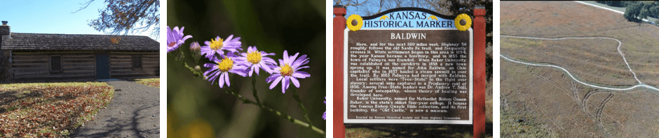
Looking for places to Visit? Check out the “Explore the Area” tab for local historic sites to visit! Click Explore the Area
Our new “Explore the Area” tab features information about sites of historical interest in the local area. Self-guided tours are also included. Hours of operation, background information, and links to further information on this website are included. More sites and tours will be added.

- Sites to visit that are always open:
- Black Jack Wagon Train Ruts and Ivan Boyd Boyd Prairie
- Black Jack Battlefield and Nature Park
- Historic Palmyra Well
- Signal Oak – new info on our site – see below
- Women’s Bridge
- Oakwood Cemetery
- Pioneer Cemetery
- Prairie City and Mt. Calvary Cemeteries (at same location)
- Vinland Cemetery
^^^^^
“Our Local History” & America 250 Celebration on Display at Baldwin City Public Library!

Information about each of these women is presented in “The Spirit of Kansas Women” display. Further information, including biographies, can be found on this website by following this link America 250: “The Spirit of Kansas Women” Display
- Kansas In the 1850s – description of KS life
- Bahnmaier, Carolyn Wezstein – Pioneer
- Bell, Anna Maria – Business Owner
- Brooks, Anna – Waitress, Maid, Ex-Slave
- Dillard, Mary Jane – Teacher
- Fish, Eudora – Shawnee Tribe Member
- Gill, Martha Cutter Kelley – Library Founder
- Hall, Olive Willey – First College Graduate
- Harvey, Rebecca Brooks – Midwife, Ex-Slave
- Hitchcock, Florence Mann – Early Pharmacist
- Leonard, Elizabeth Perkins – First Professor
- Lister, Mary Graham – Pioneer
- Lovejoy, Julia Hardy – News Reporter
- Magoffin, Susan Shelby – SF Trail Reporter
- Miller, Dr. Mary McQuiston – Early Doctor
- Nottingham, Roberta – Teacher
- Pendleton, Genevieve Lingard – Poet, Banker
- Prentiss, Annie Soule – Library Founder
- Robinson, Sara – Political Activist
- Simmons, Elmira Dodder – Business Owner
- Sullivan, Lucy Sweet – Early Mayor
- Taylor, Lucy Hobbs – First Dentist
- Weldon, Angeline – Civil War Army Nurse
^^^^^
Local Historic Site Open On Sundays!

^^^^^
Update on the “Save The Lake!” Project
Last year, many members of the Baldwin community rallied in support of restoring the Baldwin Lake (also known as Spring Creek Lake and the Old Lake) to its former beauty and use as a local attraction. Becky McMillen has led the committee of volunteers working with the city council to explore options to repair the severely damaged spillway. The dam is in excellent condition and does not need repairs. She also leads the group of volunteers that are cleaning up the overgrown trails and restoring access to various paths and other parts of the lake area. Find pictures and information on Facebook under “Becky D McMillen” and “Spring Creek Lake – Baldwin City, Kansas.”
The estimated price to repair the spillway is $35,000. Other small repairs, such as footbridges, are desired. The city does not have funds for repairs. The committee applied for a grant, which was denied. Baldwin community members have begun donating funds of all amounts to Becky’s committee for this project. If you are interested, please send or take donations to the Baldwin City State Bank and note that they are for the “Save the Baldwin City Spring Creek Lake” account.* Please keep your receipt since donations will be returned if the spillway is not repaired.
The committee will continue to apply for grants. Further research into the history of the building of the lake is being conducted. Read about the old brickyard currently under the lake on this website at Old Baldwin City Lake – & Brickyard.
*Mailing address for Baldwin City State Bank: 721 High Street, Baldwin City, KS, 66006, “Save the Baldwin City Spring Creek Lake” account.
Lake location: North 100 Rd. about ¼ mile east of East 1800 Rd. (east side of Baldwin)
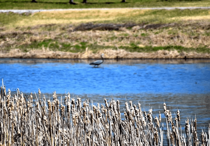

Images courtesy of Mary Jardon
^^^^^
Click this link to Join Us! (Membership)
********************************